
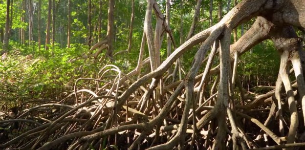
La Encrucijada, Chiapas: red mangrove forest, photo by Paula Ezcurra
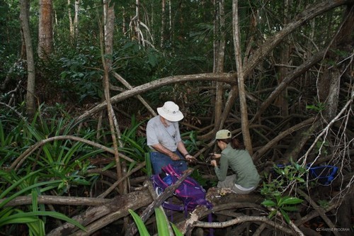
As part of the Gulf of California’s Marine Program’s ongoing research of Mexican mangrove forests, we ventured from Marismas Nacionales, Nayarit all the way down to La Encrucijada, Chiapas, coring mangrove sediments in our pursuit to determine belowground carbon content and forest age and dynamics. Our study began in 2013 in the desert mangroves of Baja California Sur, Mexico where we found peat, or undecomposed organic root matter, accumulating below black mangrove (Avicennia germinans) forests. Using carbon 14 dating, we were able to decipher the histories of these forests, and how the surrounding landscape alters their dynamics.
The varying textures and colors of the layers tells us a lot about the history of the forests (photo by Paula Ezcurra)
Now we are expanding this study to the more tropical mangroves of Marismas and La Encrucijada to see how consistent these patterns are along the Gulf. The forests in Chiapas varied greatly from what we had previously seen in Baja; there were expansive red mangrove (Rhizophora mangle) forests up to 40 meters high, with A. germinans virtually absent. There was a consistent grey-white clay horizon present in all of our Chiapas sites (see photograph above). We are eager to process these samples back in the lab because we believe this ash-colored clay may be a geological abnormality, possibly marking the Chichonal volcano eruption. The carbon analysis samples collected at both Marismas and La Encrucijada will allow us to compare how mangrove forests in Mexico vary in landforms, species composition, and age to give us a more comprehensive understand of their role in carbon sequestration.
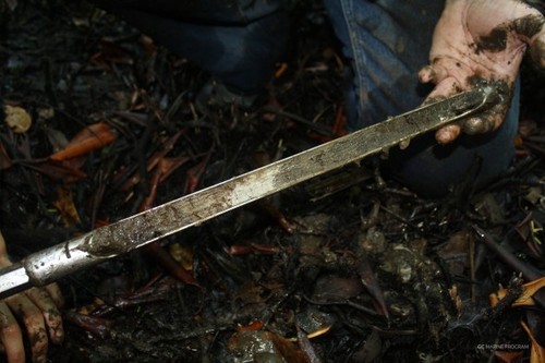
The sediment is cored using a simple open-faced sediment corer (photo by Kai Medeiros)
_________
Author: Paula Ezcurra is a recent graduate from UCSB, where she obtained a B.S. in Aquatic Biology. While there, she aided in research on California kelp forest ecology through the Santa Barbara Channel LTER. Today, Paula continues to pursue her interest in coastal marine ecology and conservation as an intern in the Aburto Lab at SIO where she has focused her work in Mexican desert mangroves as part of her involvement in the Gulf of California Marine Program.
Manglares
Números Naturales es una serie de cortometrajes que combinan ciencia, fotografía y animación para explicar el valor del capital natural de México y los conflictos de su explotación en un formato visualmente atractivo. En su cuarto episodio, NNs nos habla de uno de los ecosistemas más valiosos, los manglares.
Los manglares son árboles que han evolucionado para sobrevivir en ambientes inundables costeros. Una frágil maraña de vida que genera valiosos servicios ambientales. México es uno de los países del mundo con más manglares, pero también ocupa uno de los primeros lugares en la tasa de deforestación. Cada años se talan miles de hectáreas para ser reemplazadas por cultivos de camarón, plantaciones agroindustriales, o mega desarrollos turísticos. Al ritmo de deforestación actual, en 25 años se habrá perdido alrededor del 50% de los manglares de México.